How to Read a Custom Home Site Plan in Fort Myers
Explore Our Services
Contact Us Today!
(239) 322-9295
A custom home site plan shows how a house will fit on a specific parcel, not just how the rooms connect inside it. It can reveal flood risks, setbacks, drainage problems, utility conflicts, and limited space for a pool before construction begins.
For first-time buyers, the lines and symbols can feel confusing. Read the plan in layers, confirm which agency has authority over the property, and ask your builder or design professional to explain anything that affects cost, access, or approval.
What a custom home site plan shows
A site plan is usually drawn over a boundary survey. It places the proposed home, driveway, outdoor areas, utilities, grading features, and property constraints on the lot.
House footprint, property lines, and existing structures
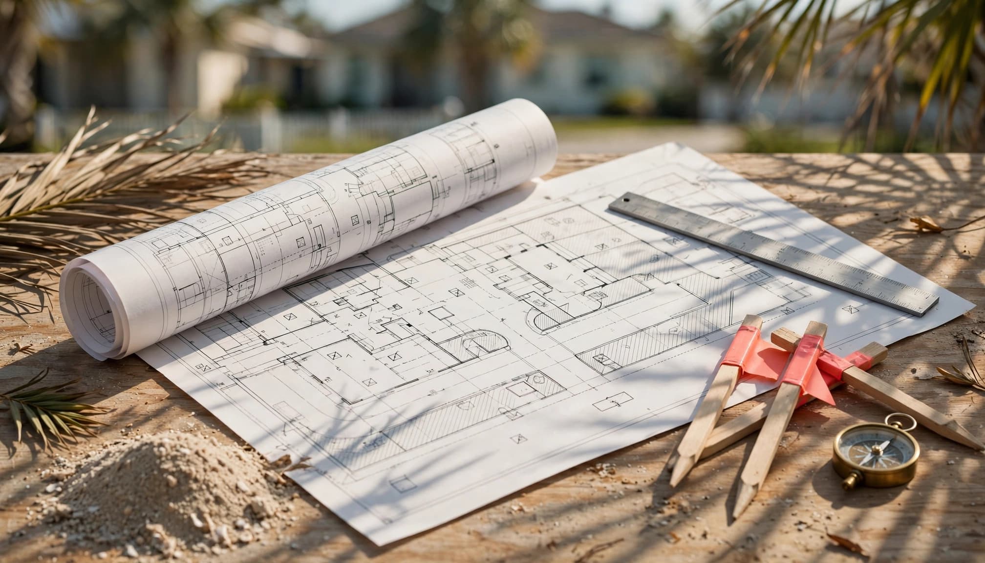
Start by finding the property boundary. It may appear as a heavy line around the parcel, with dimensions shown along each side. The house footprint should sit inside that boundary, with measured distances to the front, rear, and side lines.
Look for existing trees, sheds, wells, septic features, driveways, seawalls, utility poles, and older structures. The plan should distinguish between items that remain, items that will be removed, and proposed improvements.
Next, compare the home footprint with the survey. A garage, covered lanai, roof overhang, entry walk, or screened enclosure may affect setbacks even when it doesn't look like part of the main house.
A builder handling Fort Myers custom home construction should explain how the footprint relates to the lot's shape, access, drainage, and future outdoor plans.
Flood zones, BFE, and ground elevations
Fort Myers plans may show flood hazard areas, floodway boundaries, flood zones, base flood elevation (BFE), and existing ground elevations. These details matter because a house on a low-lying parcel may require different foundation, elevation, drainage, and material decisions.
In a special flood hazard area, the lowest floor, including a basement, must be at or above the applicable BFE under the City of Fort Myers requirements. Don't assume that one elevation rule applies to every nearby jurisdiction or project. Ask the design team to confirm the current requirement with the local floodplain official.
The plan may use spot elevations, contour lines, or proposed finished-floor elevations. A small number beside a point can show the height of existing ground or planned grading. Your surveyor, civil engineer, or builder should explain which elevations are existing and which are proposed.
Identify the jurisdiction and plan set
Before reviewing details, confirm who will approve the project. A property inside Fort Myers city limits follows the city's process. An unincorporated Lee County property follows county procedures. Fort Myers Beach and other nearby municipalities may have different requirements.
Confirm the permit authority
The jurisdiction can change the required drawings, review process, inspection sequence, and application documents. Lee County's Land Development Code is currently codified through Ordinance No. 25-09, enacted April 15, 2025, but requirements can change as codes and local procedures are updated.
Ask whether the project needs separate approvals for the home, driveway, pool, septic system, seawall, clearing, or stormwater work. A single site plan may support several applications, but each trade or improvement can have its own review.
A clean new-home application in Fort Myers may take about four to 10 weeks, while complex sites can take 10 to 16 weeks or longer. Review the Fort Myers permit and inspection schedule before setting a move-in date.
Keep the approved drawings with the project
Once the permit is issued, compare the approved plan with the version you reviewed during design. Revisions can affect setbacks, drainage, pool placement, doors, windows, and utility routes.
Approved drawings and the inspection record board should remain at the job site. This gives inspectors and subcontractors access to the same approved information and reduces confusion when field conditions require a question.
Read the buildable envelope in layers
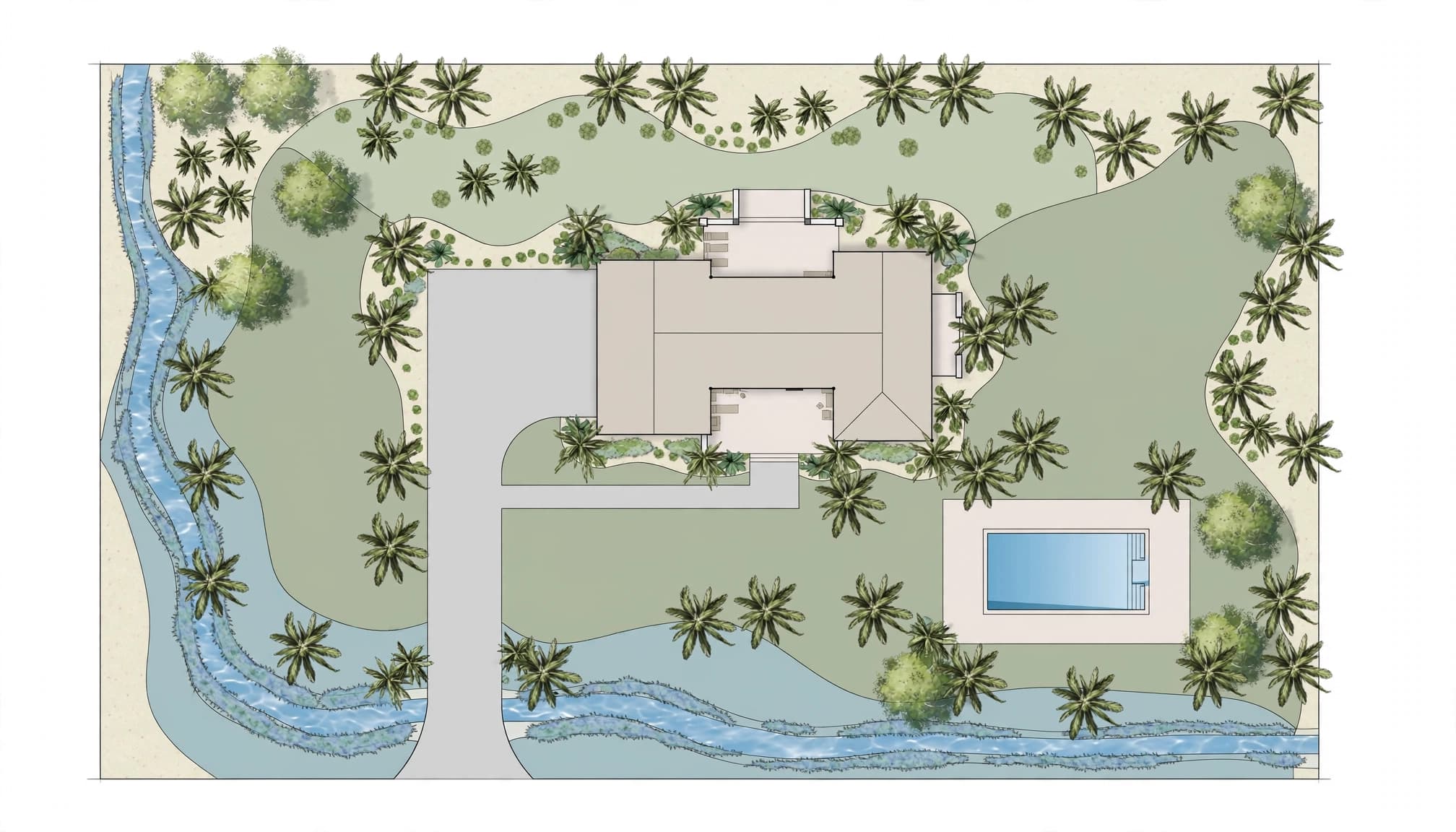
The buildable envelope is the area where the home can legally and practically go after setbacks, easements, flood requirements, drainage, and access are considered.
Check setbacks before the floor plan
Setbacks are measured from property lines, rights-of-way, easements, or other features. They can vary by zoning district, lot width, street classification, waterfront conditions, overlays, and the type of structure.
Some Lee County examples use a side setback of 10% of lot width or five feet, whichever is greater. Another example uses a rear setback of one-fourth of lot depth, capped at 20 feet. These are examples from particular rules, not universal Fort Myers standards.
Ask the designer to draw the setback lines clearly. Then check whether the garage, porch, pool deck, air-conditioning equipment, generator, and screened enclosure remain outside restricted areas.
Find easements and rights-of-way
An easement gives another party a right to use part of the property for access, utilities, drainage, or maintenance. An easement may not look like a physical feature, but it can limit where you build.
Look for utility easements along side or rear boundaries. Also identify road rights-of-way, drainage easements, access agreements, and any recorded restrictions listed in the survey or title documents.
Don't place a structure, fence, pool, or large tree in an easement without written confirmation from the relevant authority. Moving an improvement after construction can be expensive.
Follow the driveway to the street
Trace the driveway from the garage or parking area to the public road. Check whether it crosses a swale, drainage feature, sidewalk, culvert, or utility connection.
The plan should show how water continues to move after the driveway is installed. It should also identify sight-distance concerns, the driveway connection, and any required approval from the city or county.
There is no single driveway width that applies to every Fort Myers property. Ask the builder to verify the current standard for your road, zoning district, and lot conditions.
Check drainage and impervious surface
Southwest Florida sites often depend on careful grading and water control. A plan that looks attractive can still create problems if it sends runoff toward a neighboring property, blocks a swale, or leaves too little room for detention.
Count more than the roof
Impervious surface includes more than the house. Depending on the applicable code, it can include driveways, sidewalks, patios, concrete, asphalt, compacted limerock or shell, parking areas, and pool-related improvements.
Lee County stormwater rules can trigger detention requirements when a project adds 5,000 square feet or more of impervious surface to a parcel or drainage area, whichever is more restrictive. Phased work can count cumulatively.
City of Fort Myers pool materials also flag a possible stormwater user fee adjustment when new impervious pool area exceeds 500 square feet. These thresholds are not the same thing, and neither should be treated as a general lot-coverage limit.
Review grading, detention, and excavation
Look for arrows or contours showing the intended direction of surface water. Identify swales, inlets, dry retention areas, detention ponds, overflow routes, and proposed fill.
A large excavation may have additional setbacks. Cited Lee County provisions include 25 feet from a local-street right-of-way or easement, 50 feet from a collector or arterial, and 50 feet from a separately owned private property line. The exact rule depends on the project and applicable code.
For planning purposes, local 2026 estimates place civil engineering and site preparation around $15,000 to $25,000 for a simple inland lot, $25,000 to $40,000 for a lot with moderate drainage needs, and $40,000 to $50,000 or more for low-lying, coastal, septic, or utility-limited properties. These are planning ranges, not quotes. Review Southwest Florida civil engineering costs with your project team.
Verify utilities before approving the design
A site plan may show utility connection points, but it doesn't prove that every service is available or located where the drawing assumes.
Confirm municipal water, sewer availability, electrical service, communications, gas, septic eligibility, well conditions, and service-lateral routes. Ask whether any utility easement crosses the planned garage, pool, driveway, or addition area.
The electrical meter and panel route also deserves attention. Check that flood elevation, grading, screens, future landscaping, and outdoor equipment won't block access. Discuss future loads such as a pool, generator, electric vehicle charger, solar system, or workshop before rough electrical work begins.
If the lot uses septic, the drain field and reserve area can take up a large portion of the usable yard. The plan should show required separation distances and access for maintenance. Never assume a nearby property connection guarantees service for your parcel.
Review pools and waterfront constraints
A pool should appear on the site plan early, even if construction will happen after the home. Its location affects drainage, excavation access, equipment placement, screen enclosures, setbacks, and electrical bonding.
Pools, patios, decks, tennis courts, and other nonroofed accessory features more than 3.5 feet above grade may have to meet setback rules. In a cited special flood hazard provision, certain water-body placements use different distances, including 10 feet from an artificial or seawalled water body or 25 feet from a nonseawalled natural water body. Confirm the current rule for your parcel.
The pool plan should also show shell dimensions, steps, benches, spa features, equipment, deck, drainage flow, and safety barriers. Southwest Florida lots may have shallow groundwater, sandy soil, limestone, swales, or restricted access. Excavation may require temporary dewatering.
A team providing custom pool construction in Fort Myers should coordinate the pool with the house, lanai, utilities, and final grading instead of treating it as an isolated backyard project.
For flood, wind, and elevation questions, review the project's Southwest Florida hurricane building codes with a licensed professional. Local rules and flood maps control the final design.
Key Takeaways
- Confirm whether the City of Fort Myers, Lee County, or another jurisdiction issues the permit.
- Read the boundary survey, setbacks, easements, flood information, and elevations before judging the house footprint.
- Count driveways, patios, pools, decks, and compacted surfaces when reviewing drainage.
- Verify sewer, septic, electrical, water, and utility easements before approving the layout.
- Coordinate the pool, lanai, grading, and outdoor equipment during the home design stage.
- Treat every setback, elevation, and stormwater number as project-specific until the responsible authority confirms it.
Questions to ask your builder or design professional
Use this checklist during your site-plan review:
- Which jurisdiction reviews this property, and which permits will the project need?
- Is the boundary survey current, and does it show all easements and rights-of-way?
- What are the required front, side, and rear setbacks for this lot?
- What flood zone and BFE apply, and what finished-floor elevation does the design use?
- Where does stormwater go after the house, driveway, pool, and patio are installed?
- Does the project trigger detention, drainage improvements, or a stormwater fee?
- Are municipal water and sewer available, or will the property need a well or septic system?
- Where will meters, panels, pool equipment, generators, and future utilities go?
- Does the pool meet current setbacks, safety, drainage, and access requirements?
- Who will revise the drawings if the survey, soil, or excavation conditions change?
- Which professional will seal the survey, structural, civil, flood, and pool drawings?
- Will approved plans and inspection records remain available at the job site?
FAQ
Can I read a site plan without construction experience?
Yes. Start with the property boundary, then find the house footprint, setbacks, driveway, utilities, drainage features, and pool. A professional should explain symbols and measurements that affect approval or cost.
Is a site plan the same as a floor plan?
No. A floor plan shows rooms inside the home. A site plan shows the home in relation to the property, street, neighboring parcels, utilities, elevations, drainage, and outdoor improvements.
Can the house be moved after the plan is approved?
Possibly, but moving it may require revised drawings, another review, or changes to setbacks, grading, utilities, and structural documents. Ask for written approval before changing the approved layout.
Why does the jurisdiction matter so much?
City limits, unincorporated county areas, and nearby municipalities can follow different zoning rules, permit procedures, flood requirements, and inspection processes. Confirm the authority before final design and pricing.
Conclusion
A custom home site plan is a working map of how your home will occupy the land. The most important details are often outside the house footprint: flood elevation, drainage, easements, utilities, setbacks, and room for future improvements.
Review the plan before finalizing the design, then have the current requirements confirmed by the proper authority, surveyor, architect, engineer, and licensed builder. That early review can prevent a beautiful design from becoming an expensive construction problem.